
Emergency Services
Drone footage and thermal imaging can be highly effective in this service sector. Thermal detection represents a leap forward in combating the destructive potential of wildfires and in search and rescue of missing persons in wilderness areas. It’s ability to enhance early response efforts helping to protect lives and property underscores its value as a critical tool in wildfire and search and rescue management. With the integration of this technology, the devastating impact of wildfires, as well as time spent locating missing persons, can be significantly reduced.
Search & Rescue Using Drones
Our team will utilize the advanced technology in drones to fly over areas that need to be searched in a very cost-effective way. Our footage can be made available in real time to Search and Rescue Centres.

Fire Services: Using Thermal Imaging Cameras on Drones
Wildfire hotspot mapping is an essential tool in BC fire management, leveraging the power of technology to detect and respond to potential fire outbreaks swiftly. Thermal wildfire hot spot detection offers crucial advantages by swiftly identifying areas where wildfires could ignite or have already started. Our team will utilize the advanced technology in thermal imaging to detect heat signatures from the ground, allowing for the rapid identification of potential fire threats.
What Is The Best Thermal Detection Technology?
At JK Aerial we use thermal imaging cameras mounted on drones. These cameras capture the infrared radiation emitted by objects on the ground, translating heat differences into visual data that can be analyzed in real-time. Sophisticated algorithms within our cameras process this data to highlight anomalies that indicate the presence of a heat source, which could be a nascent wildfire, a lost person, or a missing pet.
Ready to get started? We invite you to call & learn more about our expertise & experience.
Call Today
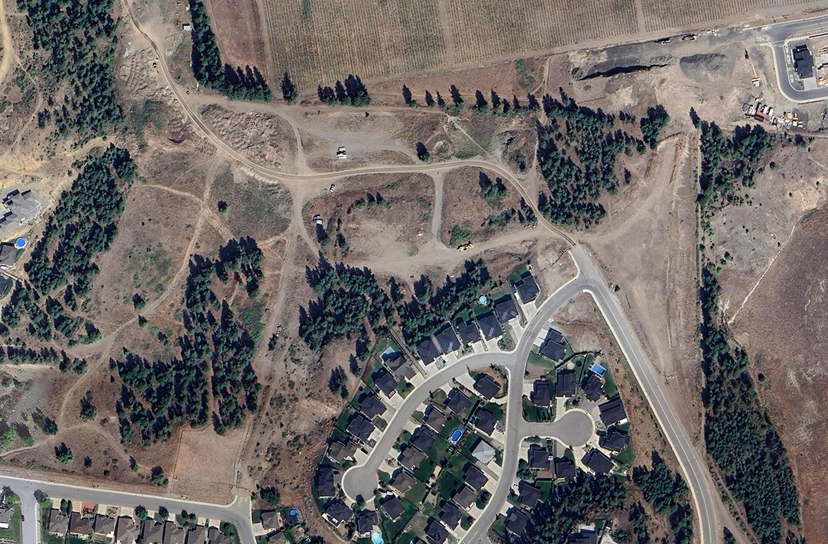
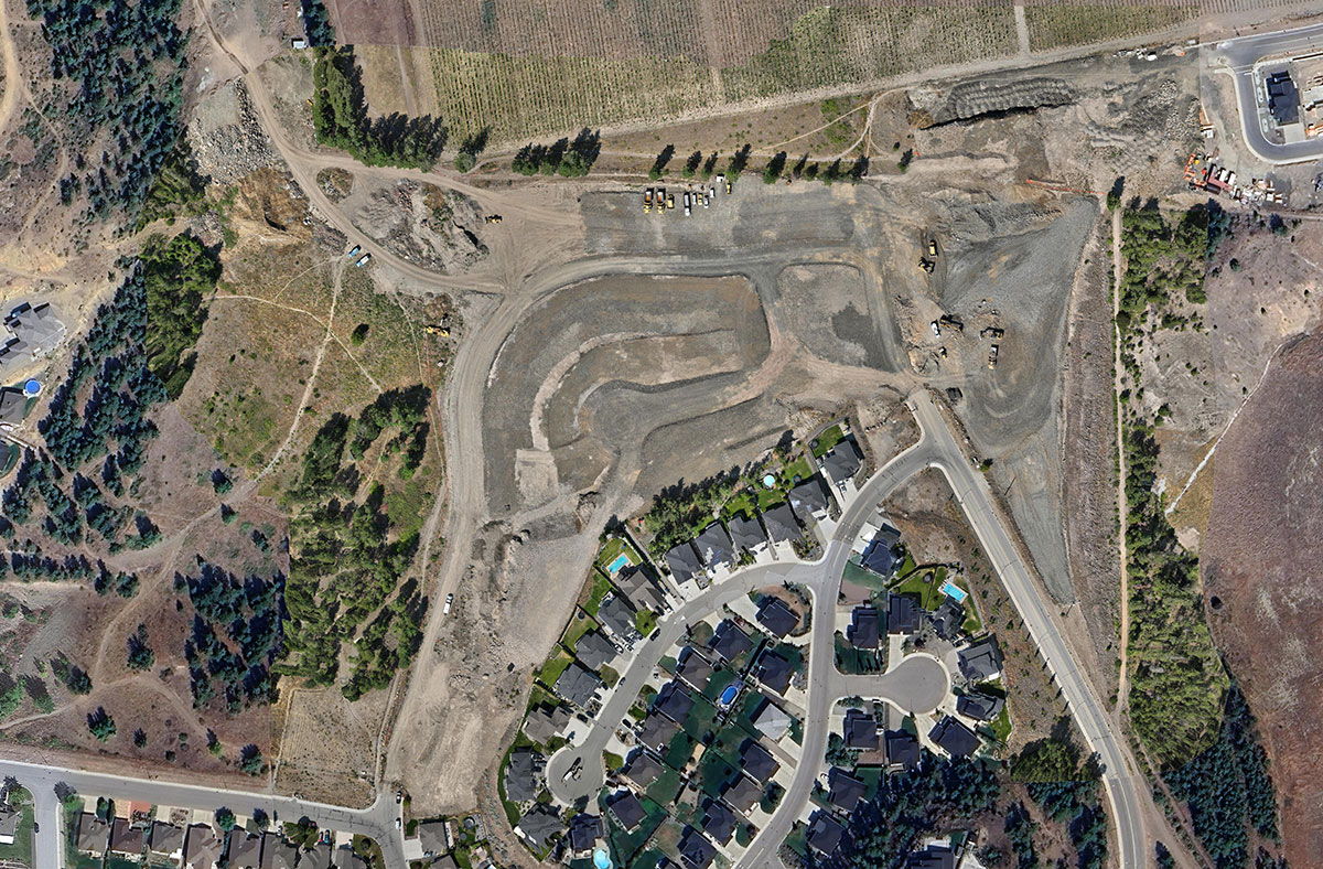
Construction
JK Aerial Services For Your Next Construction Project
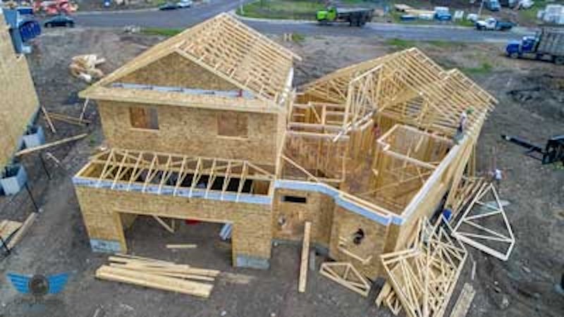
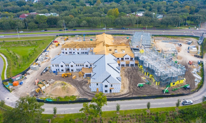
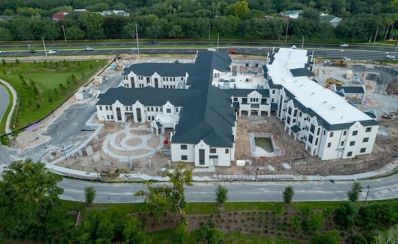
Using Drones For Construction Progression Monitoring
At JK Aerial Services we offer drone videos that track progress on construction projects over time. The footage is then uploaded to a dedicated website called “VIEW THE BUILD” to visually transform your blueprints into reality. Our platform is for both residential home builds, and commercial projects, providing owners, architects, general contractors, and trades real-time updates on the project from inception to completion. Explore before-and-after visuals, keep your project on time and on budget, and see the craftmanship that is going into your property.
Benefits of Using Drones To Track Construction Progress
- Visual documentation of your project’s progress
- Offers compelling visual materials for marketing to potential clients
- Shows builder transparency
- All imagery is available for download from one online location
- Enables project managers to monitor and assess the status of various tasks and timelines.
- Increases client satisfaction by providing transparency and evidence of progress.
- Creates a valuable historic archive of the construction process for future references.
Types of Imagery Used in Construction
Utilizing drones and ground-based equipment, JK Aerial Services can capture the following types of imagery.
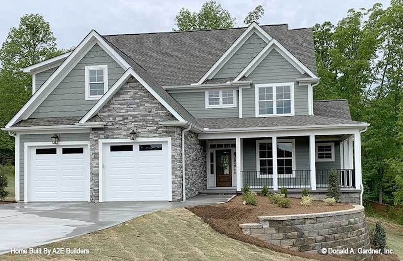
Before & After Drone Imagery from JK Aerial Services
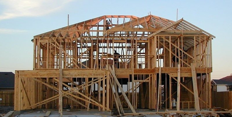
Construction before and after imagery showcases a project’s evolution. This footage delivers full project transparency, helping to inspire confidence in your clients, demonstrate the quality of workmanship, and document progress on the design plans. These visuals can serve as a compelling marketing tool, building a contractor’s reputation and attracting new clients by showcasing their expertise and successful outcomes.
Slide the bar from side to side and see the changes

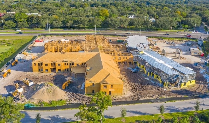
Orthomosaic
Orthomosaic maps, created by stitching together aerial images, offer numerous benefits. In construction, these maps will help with more accurate planning and resource allocation. Monitoring progress becomes systematic, helping projects stay on track, and detecting potential issues early on, preventing costly delays. Furthermore, orthomosaic maps may enhance safety by providing a comprehensive view of the construction site from above. Combine orthomosaics with “before and after” imaging for quick view referencing.
Mouse over the image around to get a closer view
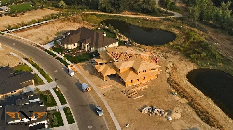
Progression Videos
Videos are not merely informative; they’re a powerful communication tool. They aid project managers in tracking progress, identifying bottlenecks, and making informed decisions. Progression videos provide an invaluable visual narrative for all kinds of building projects. These concise yet comprehensive recordings condense weeks or even months of construction into digestible minutes. Combine the power of imagery with text overlays, superimposed on the footage, to serve as an information signpost, highlighting key milestones, dates, and project details.
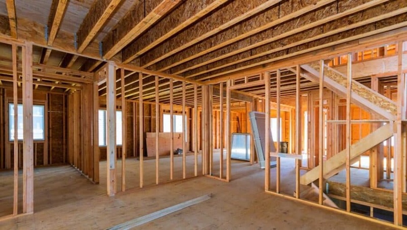
Still Images
At JK Aerial Services, we can use our drone cameras to produce still photos that capture how the construction is progressing. These snapshots provide real-time project monitoring, enhance decision making, and boost transparency. Clients will be able to view the photographs during all construction phases, while helps them visualize the project’s evolution. Elevate your construction project with our comprehensive still image solution.
Click on any image to see the quality we produce
360-Degree Images and Walkthroughs
In the construction industry, the utilization of 360-degree images and virtual walkthroughs has revolutionized project management and communication. These technologies enable clients to witness a building go up from all angles, with an excellent level of detail. Drone footage can be collected for the outside of the building and combined with stationary photos of the interior. This has become almost an industry standard in every construction project.
Get Started Today
Give us a call today to discuss your project and learn more about how drone videography can work effectively for you.
![]()
Current Project Owners, please click the logo or this link: www.viewthebuild.ca
Agriculture
Professional Drone Services for Okanagan Farms
JK Aerial Services uses advanced drone technology to help Okanagan Valley farmers optimize their farming operations. Whether you need precise crop mapping, efficient irrigation management, or detailed aerial inspections to check on fruit yields, our drone services are designed to help you run your operation more efficiently, sustainably, and with a higher ROI.
Crop Mapping
Crop mapping is an essential aspect of modern agriculture that involves the collection and analysis of data to create detailed maps of agricultural fields through multispectral imaging. Multispectral maps provide critical information about crop health, soil conditions, moisture levels, and other vital stressors and factors that influence crop production and yields throughout the growing season.
Crop mapping helps farmers make informed decisions about planting, irrigation, fertilization, and pest control. By having precise information about the condition of their fields, farmers can allocate resources more efficiently, minimize waste, and enhance the productivity of their crops. Drone footage contributes to farmers’ knowledge of their farming operation – right from land preparation to harvesting.


Technologies Used in Crop Mapping:
Multispectral Imaging
Multispectral imaging technology in our drones is used in crop mapping. This provides a bird’s-eye view of large agricultural properties and helps detect variations in crop growth, soil moisture, and nutrient levels. This information is invaluable in creating accurate and detailed crop maps.
Drones have revolutionized crop mapping. Equipped with advanced sensors and cameras, our drones fly over fields and capture high-resolution images at regular intervals. These images are then processed to create detailed maps that highlight areas requiring attention.
Crop mapping in 2024 is providing farmers with the tools and information they need to cultivate crops more efficiently and sustainably. By leveraging this cutting-edge technology, BC farmers are able to achieve higher yields, better manage scarce resources, and contribute to a more resilient food supply chain.
Energy & Utilities
Drone Assessment in the Energy & Utilities Sectors
Drones can be highly effective in providing footage during power line inspections, wind turbine pre-planning and installations, for solar farms, and in pipeline projects. All JK Aerial Services pilots are Transport Canada-certified in Advanced Operations and are fully insured, ensuring the highest standards of safety and professionalism. Located in West Kelowna, BC, we are conveniently located for projects in the energy and utility sectors of BC. We want to help your business leverage the power of drone technology for better results!
Contact JK Aerial Services today to learn how we can assist in adding imagery or video to your next project to improve the return on your investment.